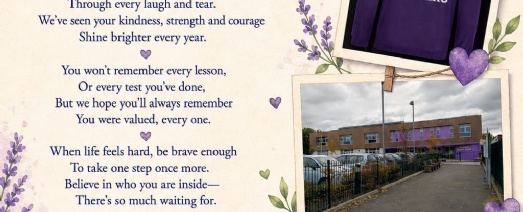
Goodbye and Good luck!
Published 17/07/26
You can find all the weekly news from Year 6 linked below.
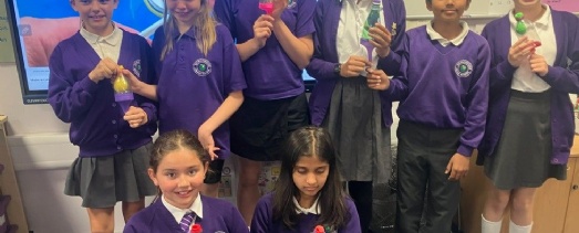
WOW! Well done Year 6! A truly team effort, to put on such a fantastic show. After months of rehearsals and hard work, it all came together this week, with a fabulous final performance, which we will all remember for a long time. All the children stepped up and worked collaboratively to showcase their acting, singing and dancing skills as well as prop-making, ticket-design and use of various technological devices.
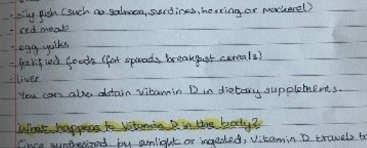
In Science this week, Year 6 have been finding out about how various nutrients affect the body. They used their Chromebooks to find out about a nutrient of their choice, and they could present their findings however they like. The results were varied and impressive.
In Science this week, Year 6 children made simple working models of the lung, to help them understand how they work. This is all part of our topic on the Circulatory System. It was quite fiddly, but they persevered and succeeded eventually.
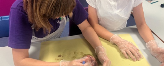
This week included one of our highlight lessons for the entire year. As an introduction to our new Science topic, The Circulatory System, the children found out about the heart. After learning about the different chambers, arteries, veins and the importance of looking after your heart, came the main event: dissection of a lamb's heart! There was much excitement as the children donned aprons and gloves, and they took the responsibility of using a real scalpel very seriously. A few were reluctant initially, but most participated with enthusiasm, as they cut into the heart to discover for themselves, what they had learnt about earlier.
%201).jpg)
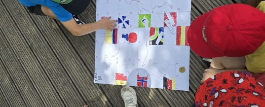
As part of our new Geography topic, the children in Year 6 have been exploring Ordnance Survey maps and using 4-figure grid references. Later, we will expand this to 6-figure grid references to enhance the precision of their map use. Learning how to unfold and fold them again was an interesting addition to the lesson! The children were also excited to find out about the exact location of our reisdential trip to Dorset in just 4 weeks' time.
The children have been working very hard to write a high-quality story, retelling the short film, 'Alma'. They have learnt about suspense writing and how to create atmosphere within their work. They have also worked hard to edit their own writing and that of their peers. The resulting narratives should be of a very high standard.
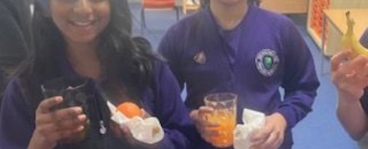
Extra breakfast has definitely been a highlight of SATs week and the children have enjoyed a less formal start to the day, before the formality of tests. They have been brilliant this week and worked extremely hard to showcase all that they know in Reading, SPAG and Maths. We are very proud of them all. After the final test was over, they enjoyed some relaxing reward time on the Trim Trail and playing their own games on the field. Thankfully, the weather stayed dry.
Year 6 carried on with lots of different core subject top ups this week, including, of course, Thursday's Year 6 only day, where the children had a balanced combination of targetted revision sessions, music and PE. They also had the school to themselves which was a rare treat! They also discussed how to notice physical concerns of health in PSHE as well as a rather frustrating sewing lesson for DT - more practise required possibly!
We are confident in saying that all of Year 6 are primed and ready to do the very best they can in their SATS next week, and we wish them all good luck.
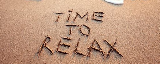
This weekend - please insist you relax, go for a walk, do some exercise, enjoy time with friends and family, eat delicious food, drink plenty of water, do the things you love and get good sleep! The homework? Just reading for pleasure. We want our children to be well rested, well-fed and physically and emotionally prepared for next week. By Thursday lunch time SATS will all be over.
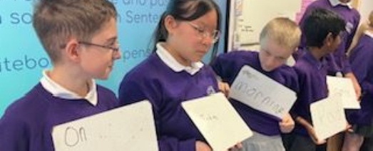
As part of our SATs revision, the children made a human sentence and rearranged themselves from an active sentence is a passive one. We also discussed which word was the subject, the verb and the object. This is just one fun way we are supporting the children with their revision.
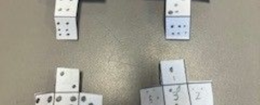
As part of our Maths learning about 3d shapes, the children were set the challenge of designing nets for dice, ensuring that opposite sides total 7. Children were surprised to find that there is more than one way to solve the challenge.